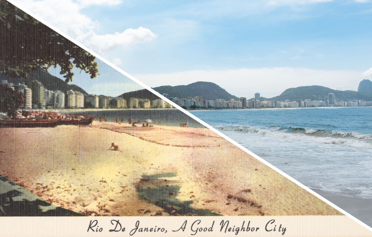
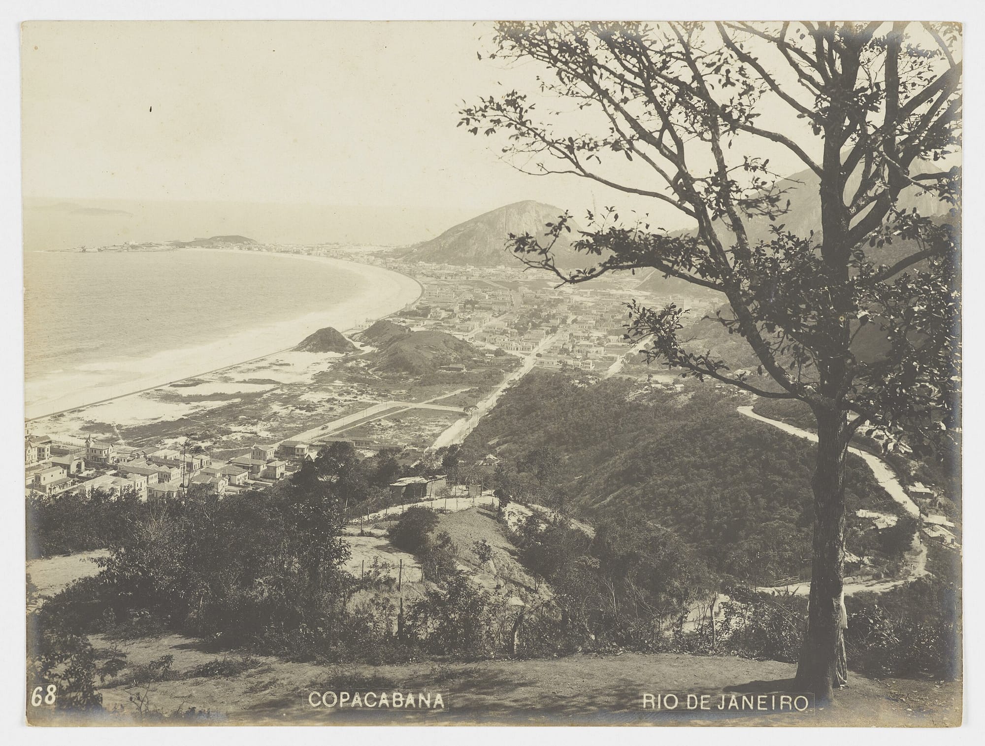
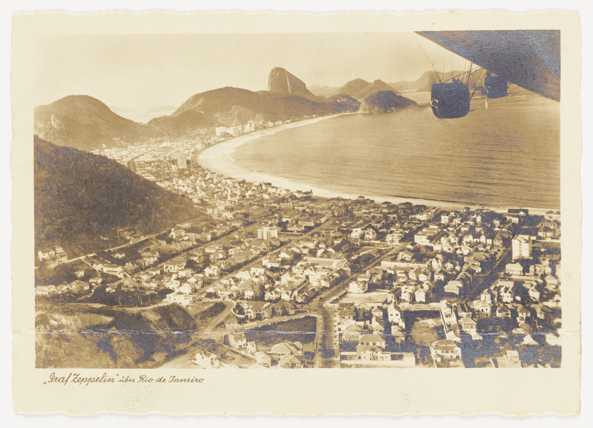
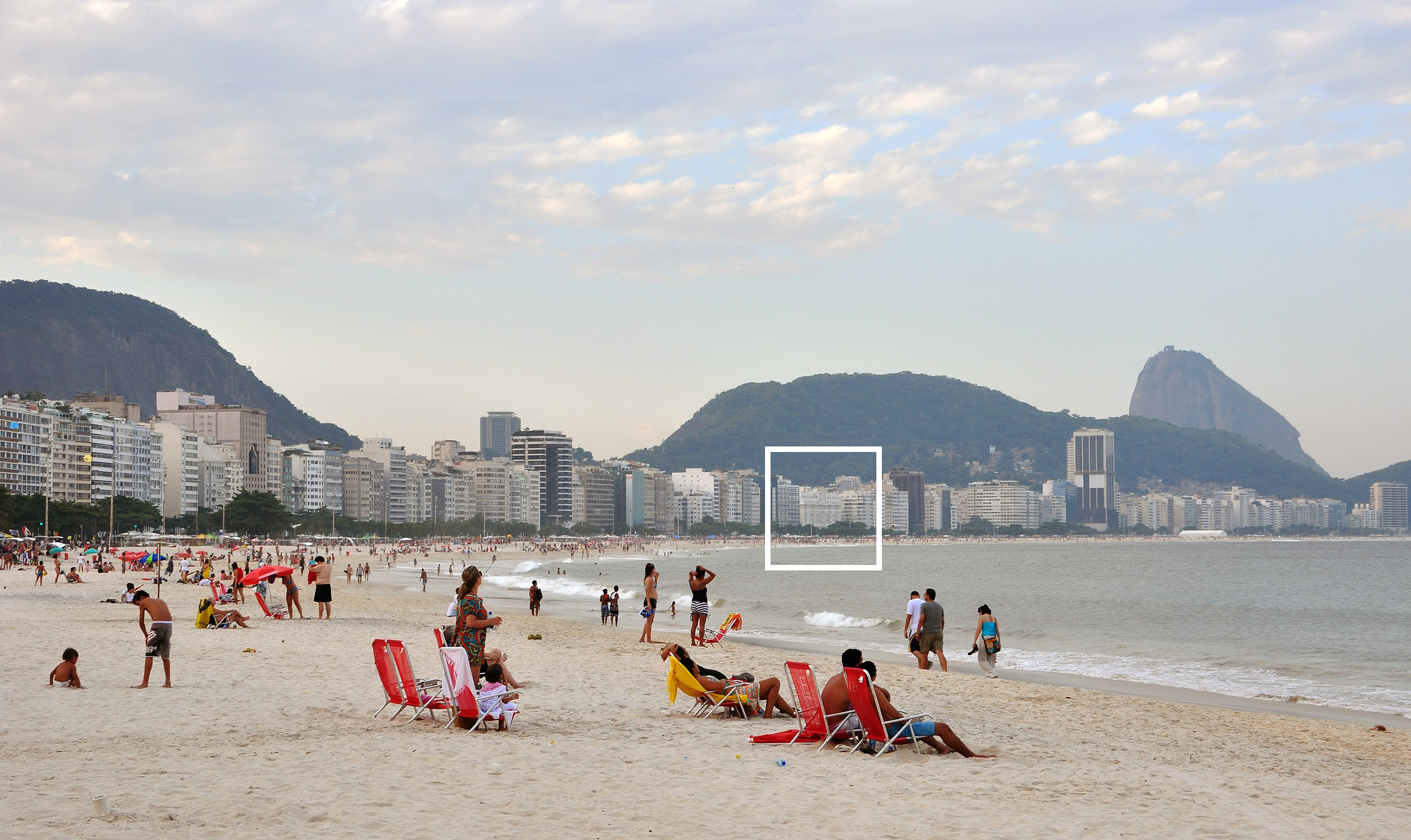
I came back from Brazil and realized I missed this one by a few hundred feet, but for an understandable reason–it turns out Rio de Janeiro expanded its iconic Copacabana Beach in a major engineering project that began in 1969, well after this mid-1950s postcard was published.
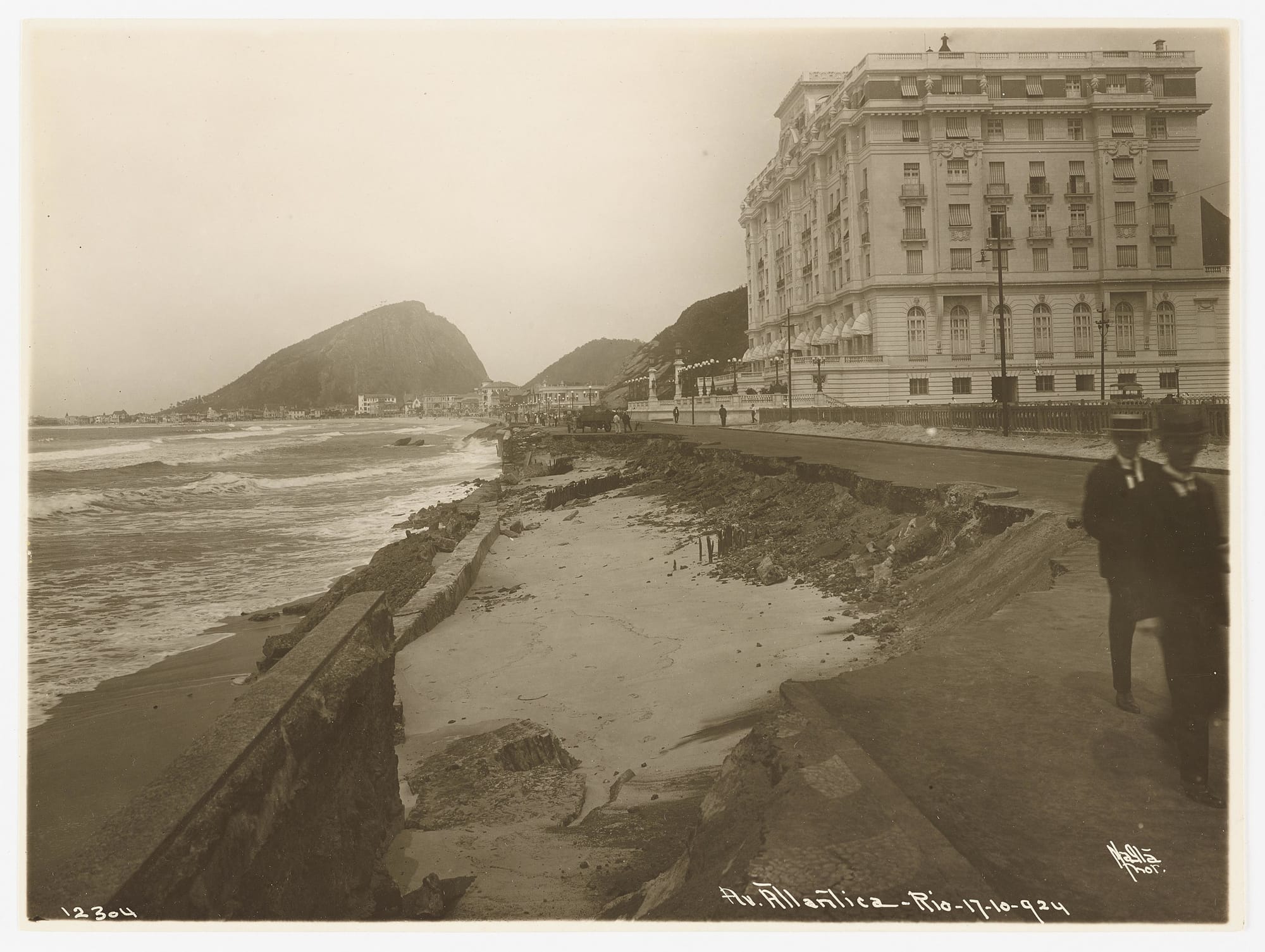
The creation of Copacabana the urban beach and Copacabana the neighborhood is inextricably tied to the construction of Avenida Atlântica, the beachfront boulevard that connects this area to the rest of Rio. For all its international renown, Copacabana hasn’t actually been around that long—work on the road that defined the beach and opened the neighborhood up to development only began in 1905, and it wasn’t completed until 1910. Violent storm surges threatened Copacabana as an urbanized beachfront on a boulevard almost immediately—within 20 years, ressacas had washed away Avenida Atlântica at least four times. To protect it, in the late 1960s SURSAN—the Superintendência de Urbanização e Saneamento do antigo Distrito Federal–embarked on a major land reclamation and rebuilding project, expanding the beach out into the sea with landfill to create today’s Copacabana.
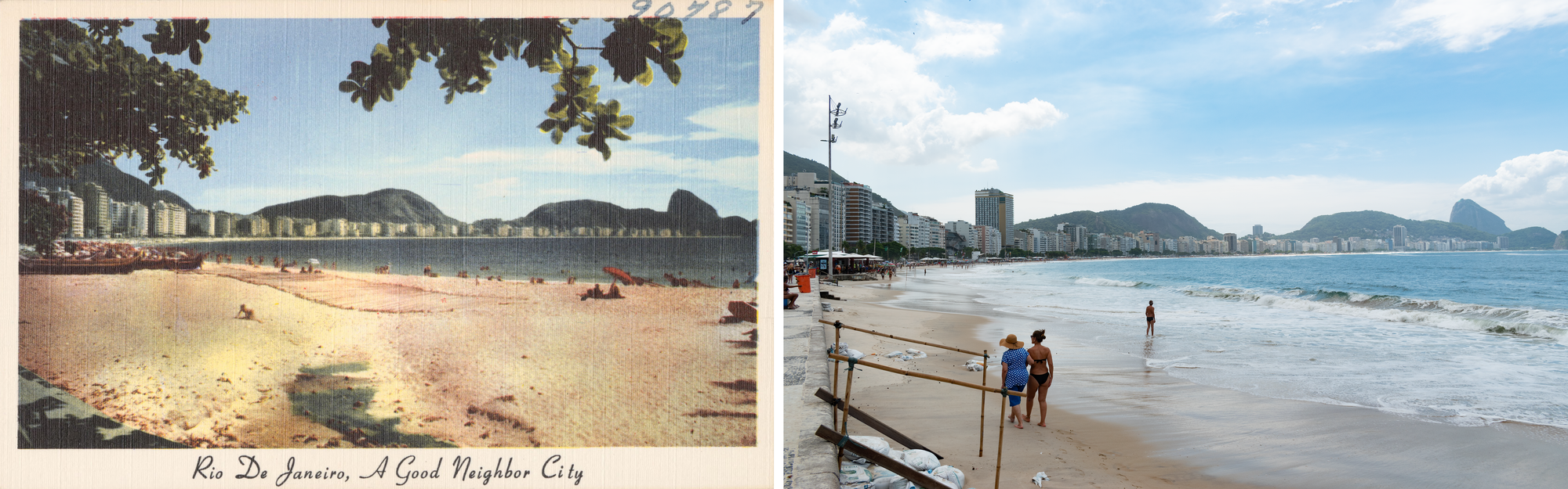
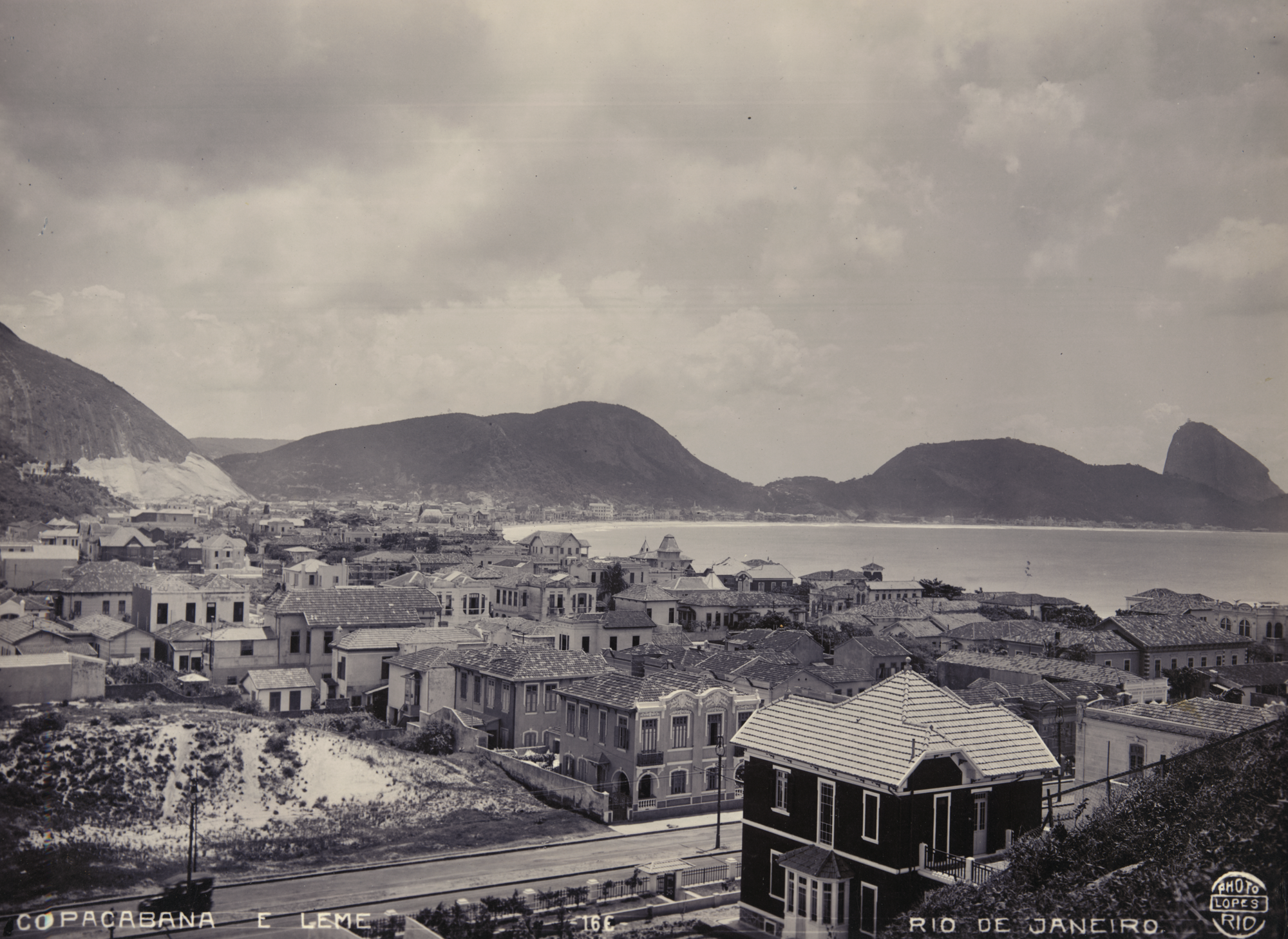
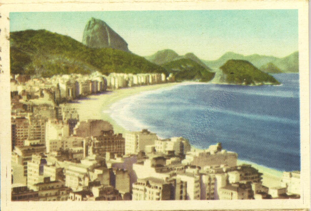
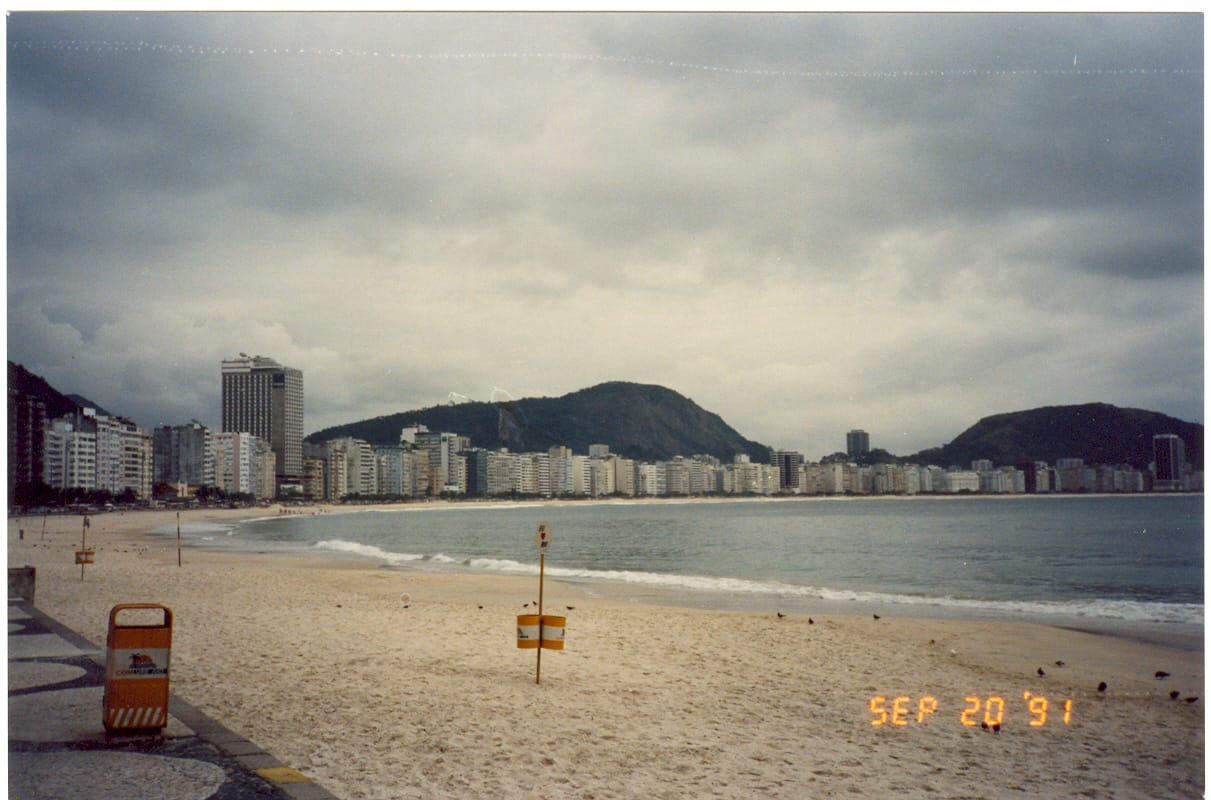
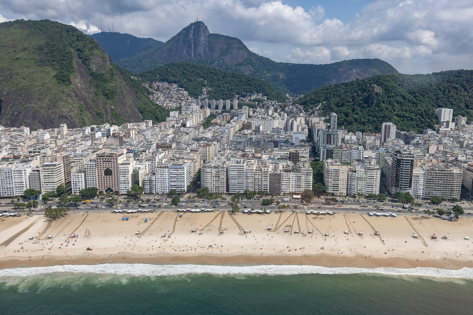
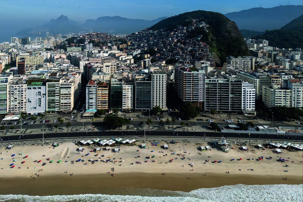
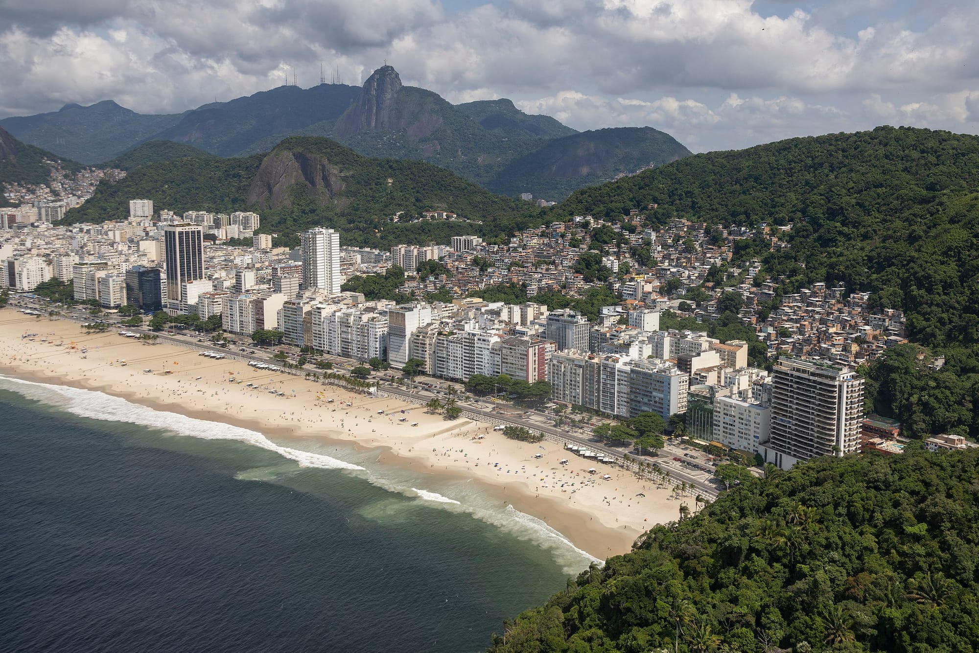
So, what’s changed? Besides adding a whole additional sliver of beach…not too much? Many of the buildings that make up the streetwall overlooking Copacabana have undoubtedly changed in the last 70 years, but from this distance the effect is basically the same: a beach lined with midrises, with the hills of (left to right) Morro de São João, Morro da Babilônia, Morro do Urubu, Pão de Açúcar, and Morro do Leme undulating in the background. The beach may have moved a bit, but the breezy, buzzing spirit of Copacabana remains.
Copacabana was an early urban beach—instead of a seaside resort for tourists or a convalescent retreat, this was a destination for cariocas, the neighborhood’s front yard. After the completion of Avenida Atlântica in 1910 connected Copacabana to the rest of Rio, the neighborhood filled in slowly and then all at once—the opening of the Copacabana Palace Hotel in 1923 came right about as the development dam burst. Building in Copacabana picked up throughout the 1920s before booming in the 1930s and 1940s. You can see the Rio city government laboring to keep pace with the development pressure—a 1937 decree legalized construction up to 10 stories, a limit which was raised to 12 stories in 1946, then 14 in 1958, and so on.
1875-1885 photo, Instituto Moreira Salles, Wikimedia Commons | 1885-1895 photo, Instituto Moreira Salles, Wikimedia Commons | 1915-1923 photo, Instituto Moreira Salles, Wikimedia Commons | 1921-1930 photo, Arquivo Nacional, Wikimedia Commons | 1927, Instituto Moreira Salles, Wikimedia Commons | 1923-1927, Instituto Moreira Salles, Wikimedia Commons | 1930s aerial, Instituto Moreira Salles, Wikimedia Commons | undated postcard, Museu Paulista, Wikimedia Commons | 1991, Wikimedia Commons
.jpg?ref=postcard-past.com)
.jpg?ref=postcard-past.com)
.jpg?ref=postcard-past.com)
.jpg?ref=postcard-past.com)
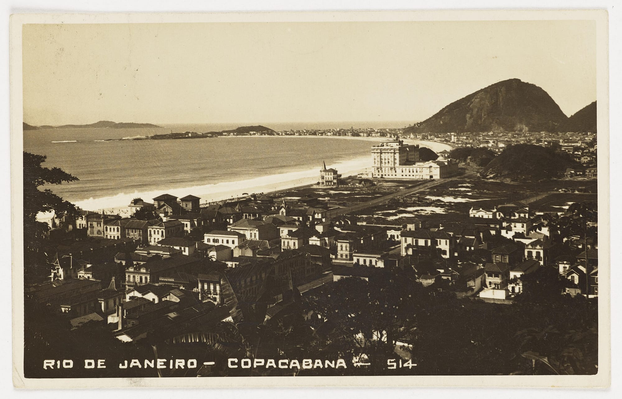
By the 1950s, Copacabana looked like this postcard, a sweep of beach and hills lined with buildings like the Edifício Embaixador. The neighborhood had also grown incredibly dense—Copacabana was home to more than 240,000 residents in the 1960s—but storm surges continued to wreck its main thoroughfare, Avenida Atlântica. It wasn’t a tenable situation for a growing city in a modernizing country.
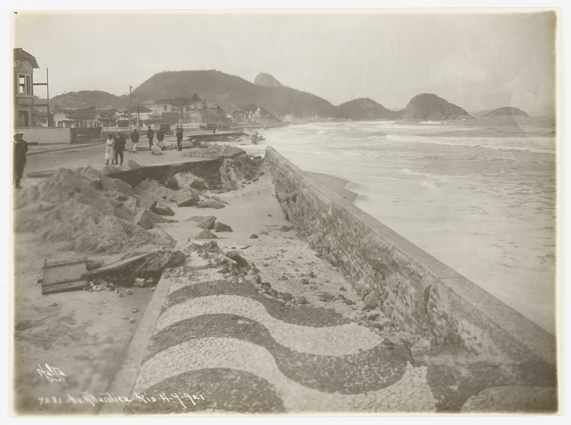
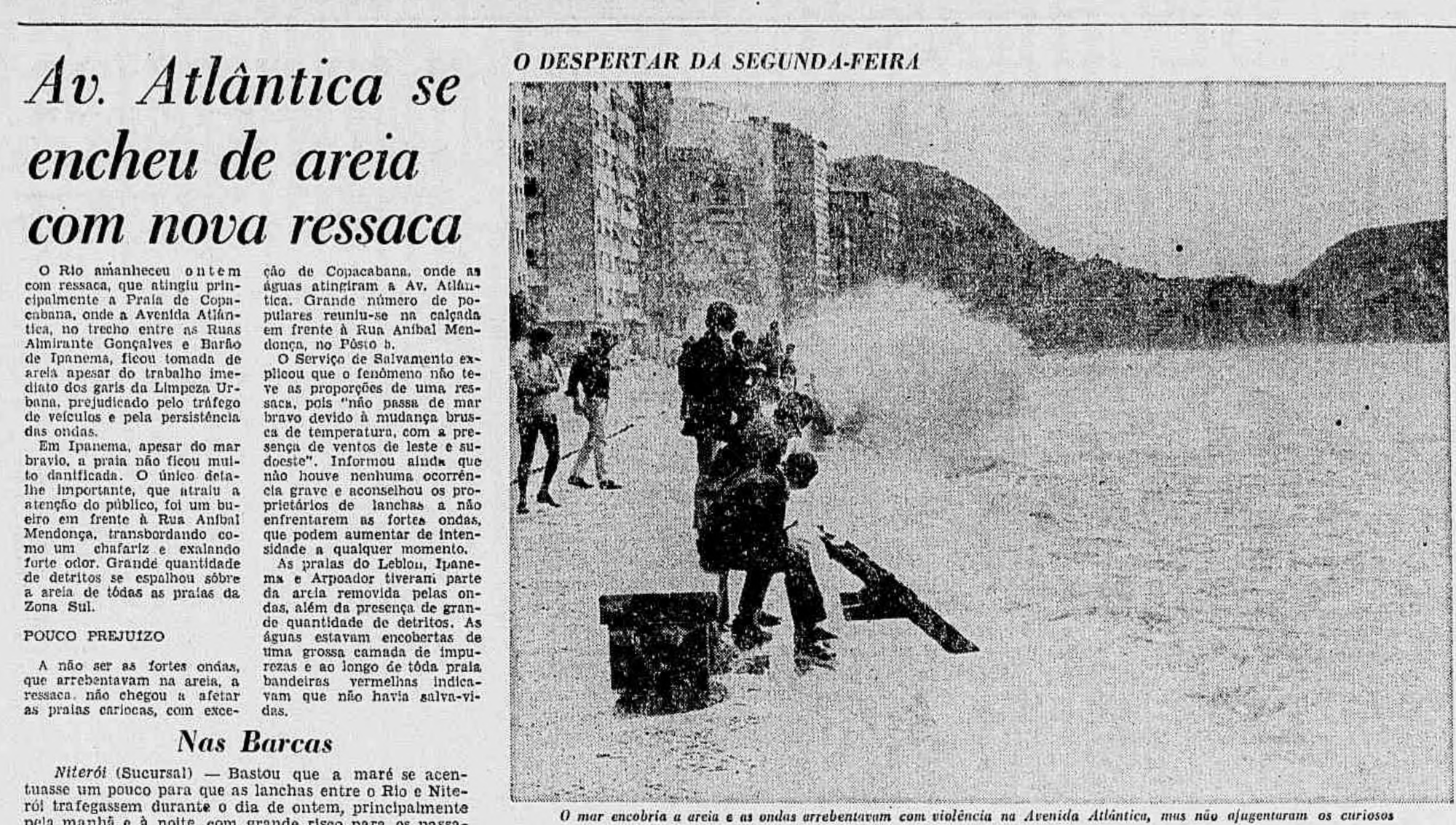
1921 ressaca, Instituto Moreira Salles, Wikimedia Commons | 1924 ressaca, Instituto Moreira Salles, Wikimedia Commons | 1968 ressaca, Jornal do Brasil, the Internet Archive
.jpg?ref=postcard-past.com)
.jpg?ref=postcard-past.com)
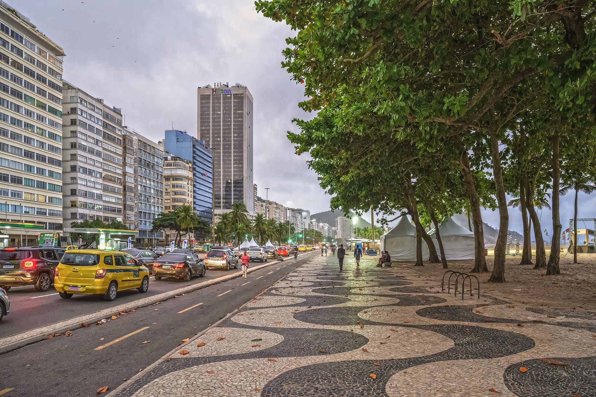
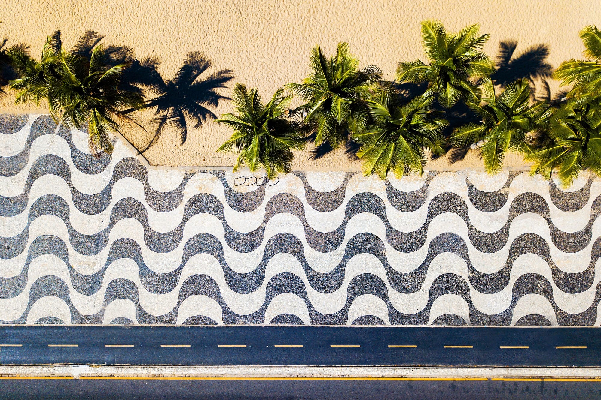
Enter SURSAN, the former federal district’s urbanization and sanitation authority. Spearheaded by engineer Raimundo de Paula Soares, from 1969 through 1971 SURSAN embarked on a project to expand Copacabana Beach and widen Avenida Atlântica, intended to protect the boulevard, improve sanitation, increase vehicle access, and preserve and improve tourist potential. To help achieve that last point—tourist potential—SURSAN tapped legendary landscape architect Roberto Burle Marx, who redesigned the Copacabana Promenade. Marx, a renowned modernist, retained and expanded the promenade’s distinctive black-and-white tile wave pattern, which dated back to at least the 1920s.
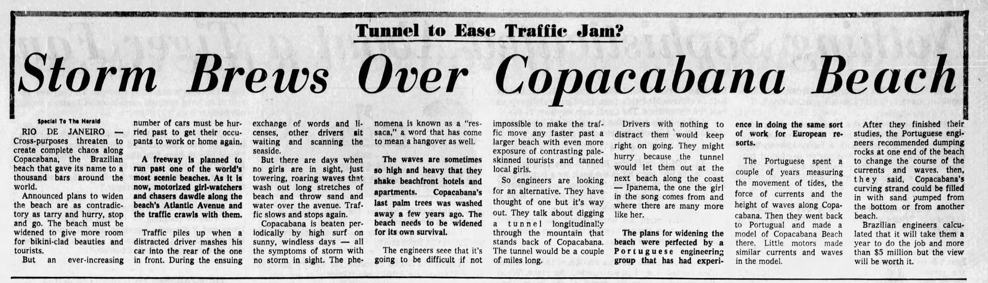
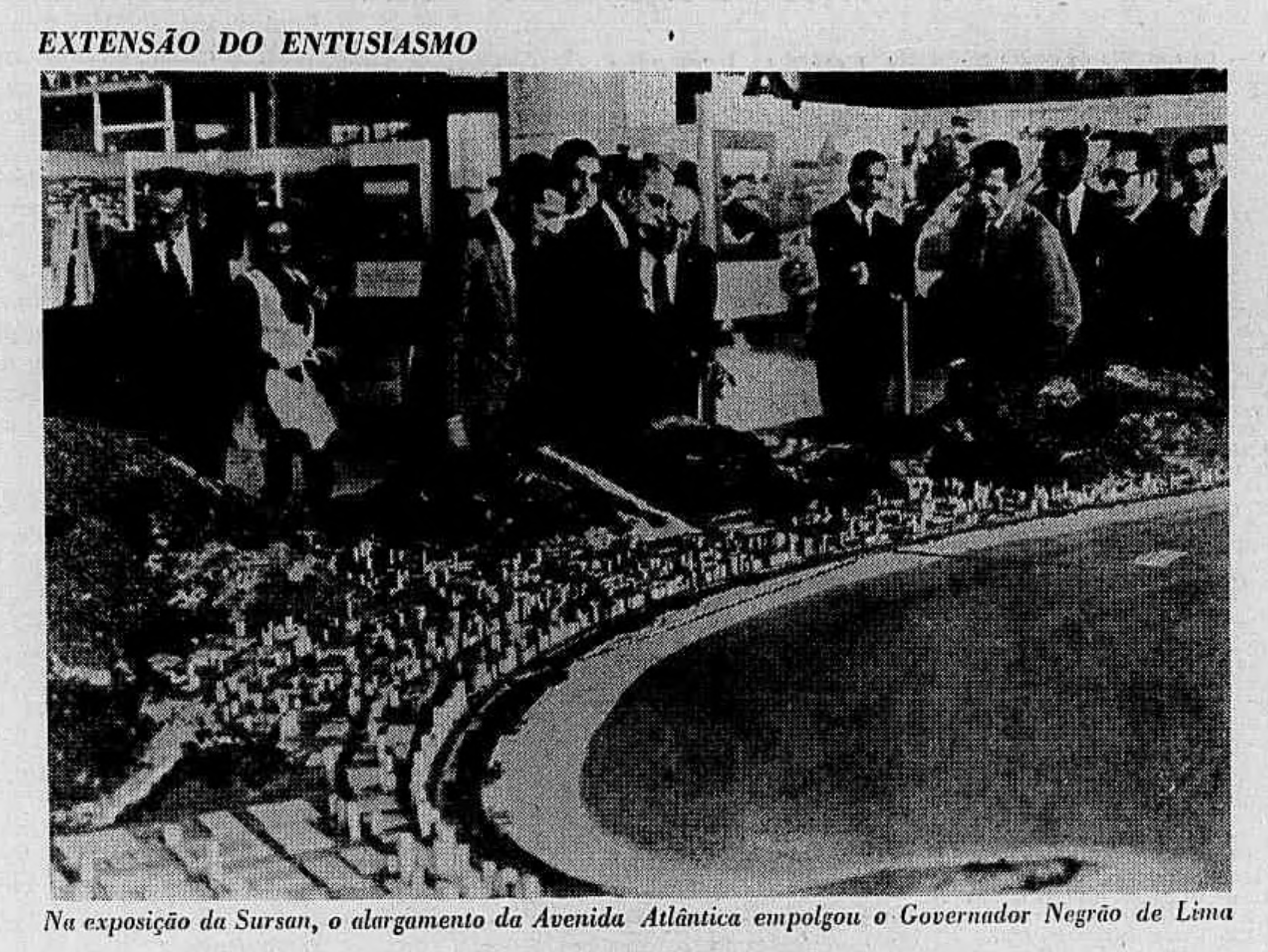
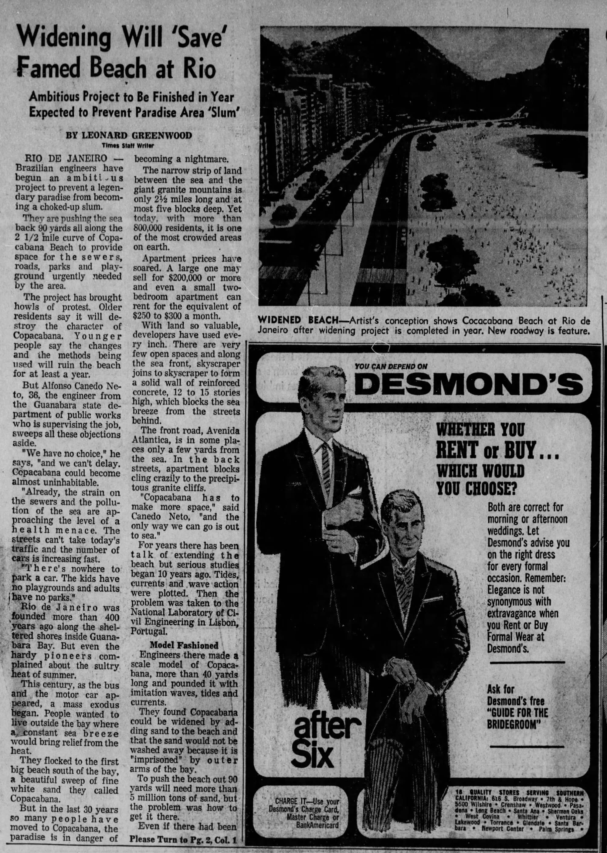
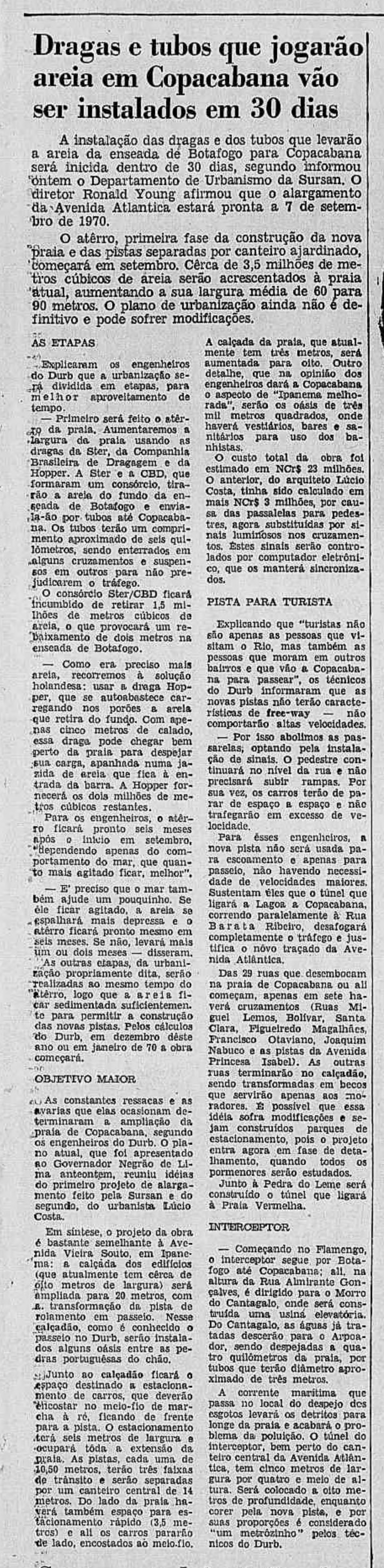
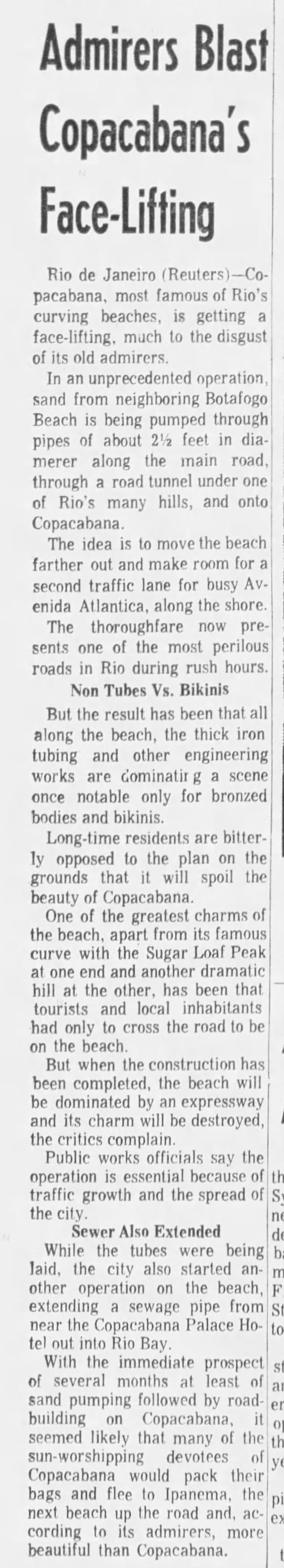
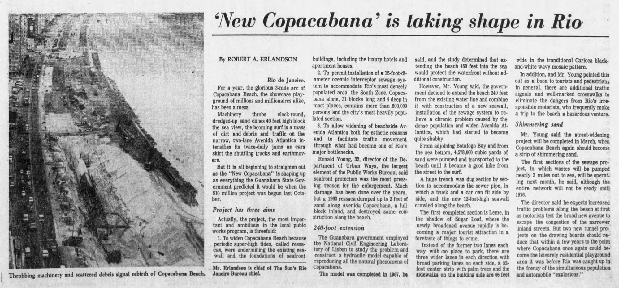
1968, "Storm Brews Over Copacabana Beach", the Miami Herald | 1969, expansion model, Jornal do Brasil, the Internet Archive | 1969, "Widening Will Save Famed Beach at Rio", the Los Angeles Times | 1969, project materials arrive, Jornal do Brasil, the Internet Archive | "Admirers Blast Copacabana's Face-Lifting", the Evening Sun | 1970, "'New Copacabana' Taking Shape in Rio", The Baltimore Sun | 2022 aerial, Arne Müseler / arne-mueseler.com / CC-BY-SA-3.0, Wikimedia Commons | 2023, Wikimedia Commons | 2021, wave pattern from above, Wikimedia Commons
Road building and real estate development, mid-century megaprojects, coastal resiliency and cultural vibrancy—Copacabana’s more than just an iconic beach, it's also a giant feat of civil, social, and environmental engineering.
(...although it really is an incredibly lively beach, too)
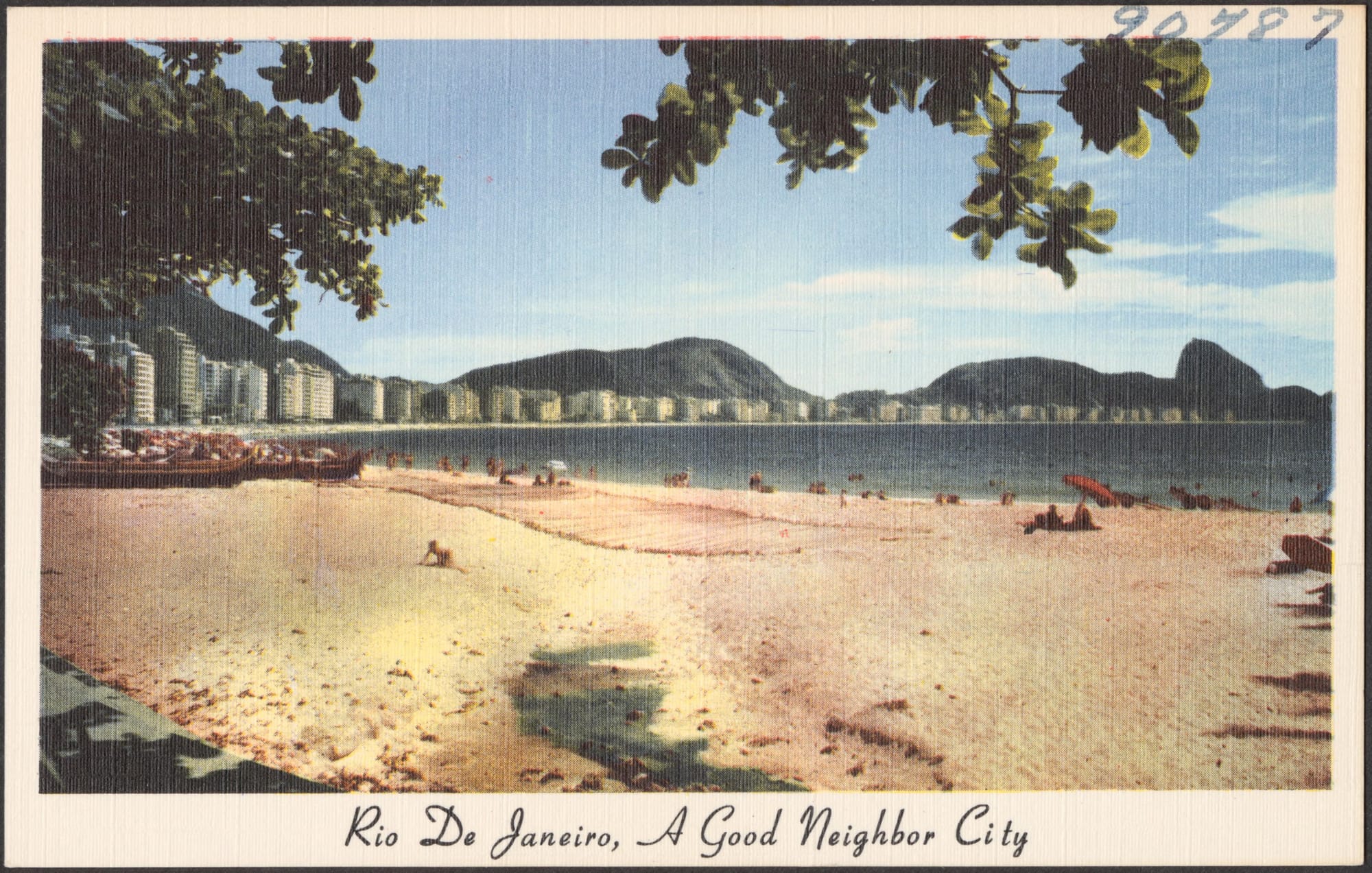
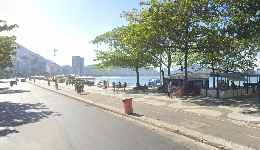
~1955 postcard | 2024 Google Streetview, (more) accurate perspective recreation
Production Files
Further reading:
- SURSAN and the Copacabana Promenade by Teba Silva Yllana, Docomomo Brasil Seminar
- Rochas desenhos e designios no calcadao de copacabana by Teba Silva Yllana, PhD thesis
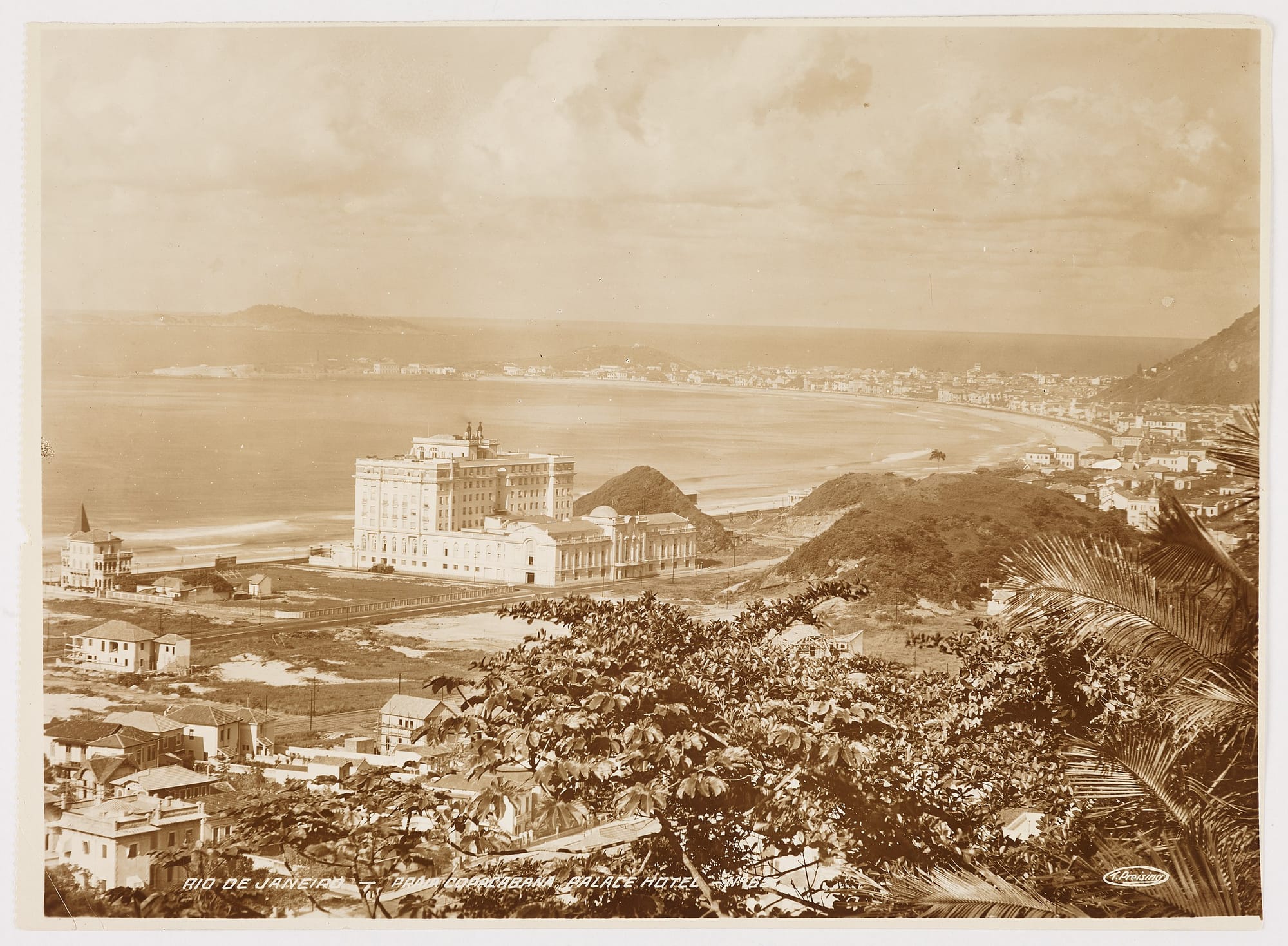
I think these really hammer home how much the SURSAN project expanded Copacabana Beach—look at how close the Copacabana Palace Hotel used to be to the waterfront. No wonder Avenida Atlântica kept getting washed out.
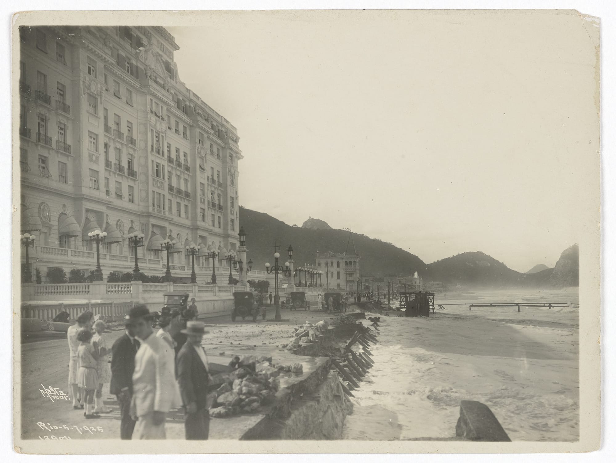
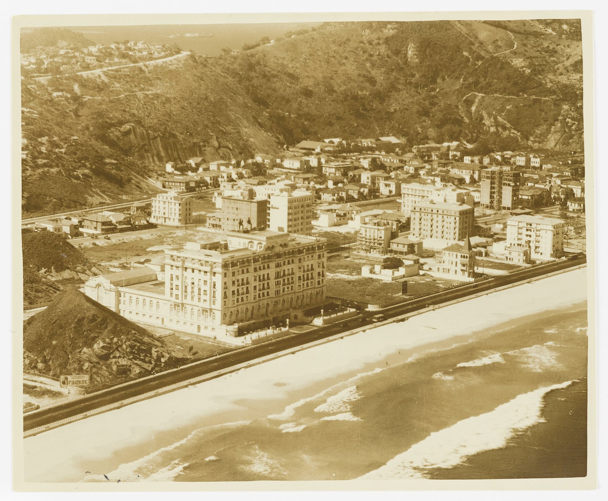
1925, Augusto Malto, Instituto Moreira Salles, Wikimedia Commons | Aerial, 2022, Arne Müseler / arne-mueseler.com / CC-BY-SA-3.0, Wikimedia Commons | Late 1920s, Instituto Moreira Salles, Wikimedia Commons | 2010, with the Copacabana Palace Hotel highlighted, Wikimedia Commons
.jpg?ref=postcard-past.com)
Member discussion: